
Hi there,
The local government geospatial alliance(LGGA), had a meeting down in Wellington on 13 February. I thought I'd give you a quick update of what we talked about at that meeting.
Representation
We are still trying to secure representation from a number of regions, LGGA members will be approaching these regions for representatives.
Project updates
Historic aerial imagery
LINZ have negotiated a contract with Opus to get the historic aerial imagery scanned. Opus have built a new archive for the Crown imagery which was opened mid-February. BOPLASS imagery is on the priority list. Scanning will be targeted towards the older imagery first, urban areas, coastal areas, lifestyle areas (potential to be redeveloped).
We have applied significant pressure to get post-processing of the imagery completed, LINZ are considering acting as a clearinghouse to support this.
We have also applied pressure for Opus to put on a second shift scanning the imagery, this will speed up the delivery of the imagery.
We’re anticipating receiving some completed surveys in the next few months.
Addressing
Linz have been running a number of addressing workshops around the country (Auckland, Manawatu), these have been well received.
A number of addressing initiatives underway from LINZ, Regions, Unitary’s – these need to be kept clear, and not confused.
LINZ taking “sore-thumb” approach to prioritising areas for regional consultation.
Tracks data
The dataset is continuing to grow through chasing requests to all councils. 11 of the 16 Regionals councils and 23 of the 67 TA’s have provided data.
LDS Statistics for the tracks data indicate that 25,000km’s track have been loaded; this data has been downloaded 187 times with 1500 views.
One of the challenges we face is that duplicate track records exist across agencies, we are attempting to find a process to resolve this challenge.
The key outstanding task for this project is to define and establish a maintenance process for the tracks data.
A coverage map highlighting councils and districts that have not provided data will be updated and published on the LGGA blog.
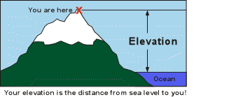
Elevation
Beca have completed a stocktake on behalf of LINZ on elevation.
A summary of their findings are:
There is broad support for a larger central government role in coordination (similar to imagery).
The information of available datasets has provided LINZ with a good inventory and we are considering aggregating existing LiDAR DEMS and point clouds.
Data and accuracy problems cause workarounds resulting in not being able to fully utilise the data.
Historic DEMs are not accurate for current demands, causing parties to collaborate to create new data.
The following activities were initiated after the initial discussions and are currently in progress and part of LINZ’s 2014/15 work plan:
Improve (LINZ’s) knowledge of existing elevation products and explore a coordination role similar to the national imagery role (LINZ) took on over the past few years.
Quality assessment and quantification of the various open license national coverage DEMs of New Zealand.
Explore a national "best available" approach providing the systematic framework to incorporate better data as it becomes available.
Options analysis of technologies and approaches in data capture and management.
A summary of other nation's approaches.
Develop user case studies to estimate economic benefit to three focus areas/sectors:
Flood risk mitigation
Coastal zone management
Land productivity
LGGA have provided some additional feedback to LINZ regarding the elevation programme. This includes:
We are supportive of a coordination role.
Develop standards and templates that councils can use when purchasing lidar, DEM’s etc.
councils often use elevation data for catchment modelling, consider hydrographically correct DTM as a standard offering.
Extend scope of case studies to include additional agencies (e.g. forestry etc.)
LDS for Canterbury

Iain Campion presented a summary of the work that Canterbury regional Council are doing with LINZ to develop an LDS instance for their area. This is a pilot project which is expected to last 12 months.
LGGA members were very enthusiastic about the potential of a local government LDS as it would:
Support LG’s success in adopting the open data declaration as data hosted by LG LDS would meet the technical standards.
Facilitate LG spatial data sharing as there would be a focal point to work to.
This has been raised with LINZ but has not proceeded due to the pilot project having constrained scope, timelines and budget.
What LGGA should be doing in 2015
We had a discussion about what LGGA should be focusing on in 2015. We are tight for resources and time they need to ensure our efforts are focused on what adds the most amount of value to local government geospatial.
The LGGA should:
Start:
Be clear on how our work delivers outcomes.
Develop a communications plan.
Establish a catchy tagline/elevator pitch.
Begin putting together a geospatial toolkit.
Develop shared PowerPoint updates on LGGA.
Stop:
Tracks project, only once maintenance processes sorted.
Continue:
Being clear on how I work delivers outcomes.
Networking and communications between local government and central government.
Representing our regional advisory groups.
Increase:
Communications:
High visibility storytelling.
With regional advisory groups.
Blog posts
Projects supporting open data.
Facilitate the reuse of Geo enable data.
ALGIM GIS symposium

LGGA will prepare a workshop for the afternoon of the first day on the ALGIM GIS symposium. This will start with a short update on LGGA and what we've been doing, followed by a couple of rounds of workshops focusing on collaboration and sharing.
Next meeting
Will be in April over video conference facilities.
Photo of LGGA members attending recent meeting

Members from left to right: Iain Campion, Sean Hodges, Susan Shaw, Gill Lawrence, Hayleigh Brereton, Dave Withington, Rob Garrett